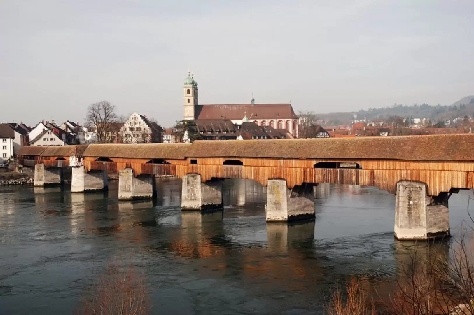
Holzbrücke, from the car park at Bad Säckingen station

Edited by:
Massimo Martini
Updated at: 01/08/2026
Access
Road directions
From Giebenach, in Switzerland, join the and continue for 33m until junction 9, where you should take the right-hand lane, following the signs for the E60/ towards Zürich/Rheinfelden. Follow the /E60 for 19.3 km (19.3 km) until you reachexit 16-Eiken, towards Eiken/Stein/Säckingen/Laufenburg, then follow the slip road for 900m (20.2km) and the middle lane for a further 44m (20.2km in total) until youjunction with Road 7 (Laufenburgerstrasse). At the roundabout, take the third exit, continuing along Road 7 for 1.2 km (21.5 km); at the next roundabout, take the second exit, following Schaffhauserstrasse/Road 7 towards Basel/Stein/Säckingen for 2.8 km (24.3 km). Then turn right onto the Fridolinsbrücke, the road bridge leading into German territory (entry into Germany), for 160 metres (24.4 km), and continue along Fricktalstraße/ for 700 metres (25.1 km). At the roundabout, take the first exit onto Schulhausstraße for 650m (25.8km), then continue along Alte Basler Straße for 260m (26.0km). Alte Basler Straße curves slightly to the left, becoming Waldshuter Straße for 51 metres (26.1 km); turn left onto Bergseestraße for 120m (26.2km), then right onto Güterstraße for 24m (26.3km in total) to your destination, on the right: Bad Säckingen railway station.
The route, which is entirely on motorways up to the border, involves paying tolls (Swiss motorway vignette) and crosses the national border.
Car park
Bad Säckingen station car park 🅿️ (paid), starting point of the route.
Access by public transport
Bad Säckingen station is served by trains and buses.
Distance and journey time
🕒 Journey time: 21 minutes
📏 Distance: 26.2 km
GPS navigation
Important information
The directions provided were verified on the date the route was mapped. Before setting off, we recommend checking for any changes to the route or road conditions. For up-to-date information, please consult Google Maps or Apple Maps.
Introduction
Between Bad Säckingen and Stein, the border between Germany and Switzerland runs down the middle of the Rhine and can be crossed on foot via the historic Holzbrücke. At 204 metres long, it is the longest covered wooden bridge in Europe and connects the centre of the German town directly to the Swiss bank.
The appeal of the walk lies not so much in the distance as in the crossing itself. As you walk along the bridge, you can see the wooden beams, the openings overlooking the Rhine and, roughly halfway across, the white line marking the border between the two countries. Along the route, in the centre of Bad Säckingen, you will also come across the Fridolinsmünster, the cathedral dedicated to the monk of Irish tradition who played a key role in the Christianisation of the Rhine region in the 6th century. From the Stein bank, you can also see the Holzbrücke set against the river landscape and continue your walk along the banks of the Rhine.
The route, which is almost entirely flat and follows roads and footpaths, is classified as a tourist route (T1) and presents no difficulties in terms of navigation or terrain.
Description
0h00' 0.00km Leave your car in the car park at Bad Säckingen station and head towards the town centre along Bergseestraße. Cross Hebelweg Straße and take the pedestrianised Scheffelstraße, continuing slightly downhill until you reach the vicinity of the Fridolinsmünster.
0h06' 0.38 km After visiting the Münster, turn right onto Rhein-Brücke Straße and head for the entrance to theHolzbrücke, the covered wooden bridge linking the centre of Bad Säckingen to the Swiss town of Stein.
0h09' 0.60 km (2 m D+) (9 m D-) Walk across the wooden bridge, noting the internal beams and the side openings overlooking the River Rhine. About halfway across, a white line on the walkway marks the border between Germany and Switzerland. Once you reach the Swiss bank at Stein, continue along a stretch of the Rhine embankment, looking out for views of the Holzbrücke set against the river landscape, until you reach a panoramic spot on the embankment (286m) [0h15’T1] 1.02km .
The return journey follows the same route as the outward leg [0h15’T1] 2.03 km .
Places of interest
Fridolinsmünster
Holzbrücke
Comments (0)
Sign in to leave a comment